
Which location-based GNSS applications lasted in Asia and why?
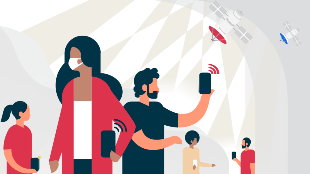
The added value of global navigation satellite systems (GNSS)-based apps is highest when it is combined with other innovative technologies. Satellite navigation and positioning information has been critical in fighting COVID-19 all across Asia, when teamed with other technologies such as radio-frequency identification (RFID), Bluetooth, cell ID positioning, big data and fifth-generation mobile technology (5G). These unique combinations have been implemented across the continent, with uses ranging from quarantine monitoring and enforcement, information dissemination, assisting medical services and ensuring social distancing measures. This article by the GNSS.asia Editorial Team provides an overview of the different uses of GNSS, as well as which applications have lasted and why.
GNSS for quarantine monitoring and enforcement
The most extensive use of GNSS in quarantine monitoring and enforcement is in setting up a virtual perimeter for those in self-quarantine, through a process known as ‘geofencing’. The location data is gathered from either a smartphone or other supporting device that will inform local authorities if somebody breaches their self-quarantine.
One notable example of a GNSS application for quarantine monitoring and enforcement emerged in South Korea, where the government made it mandatory for anyone entering the country to download the ‘Self-quarantine Safety Protection Application’ for their 14-day self-quarantine. The application connects those in quarantine with a designated case officer, who checks in with individuals twice a day. If someone violated the quarantine rules by either being detected crossing the virtual perimeter or by leaving their mobile phone at home, they were issued an electronic wristband tracker. However, use of the wristbands has been limited, as the public in general observed self-quarantine measures dutifully.[1] The authorities now trace location through peoples’ phone with their prior consent.
South Korea was not alone in introducing an application to enforce quarantine; similar measures have also been deployed in India, Singapore and Taiwan. One example of this is Quarantine Watch, an app launched by the regional government of Karnataka in south India, which tracks the movement history of those placed under home quarantine.
GNSS for precautionary measures
In addition to these intensive follow-up measures, GNSS-based applications have also been used to support precautionary measures; for example, to help identify, map and tag congested places and locations where anyone who tests positive recently travelled. This data allows authorities to provide warnings on which places to avoid and at what time.
A sophisticated example of the use of GNSS for social distancing can be seen in China’s HaiGe Smart Epidemic Prevention Management Platform. This system is a BeiDou-based system that allows hybrid indoor and outdoor positioning. This data provides details on the location history of infected patients, which is then used to facilitate real-time mapping of infection clusters and identifying potential hotspots, and advise users on areas to avoid and the best routes for commuting.
Another example is the Indian start-up Tsalla Aerospace’s artificial intelligence (AI)-enabled drones for crowd surveillance, jointly developed with the United Kingdom-based Blockapps AI. During crowd surveillance, the technology detects patterns and anomalies, which it uses to calculate the number of people present in order to allow police to decide whether they should get involved to disperse the crowd.
The solutions developed in Asia have not just been deployed locally; for instance, some of the social-distancing measures developed in China are being used overseas. In March 2021, China’s Qingyanxunke announced that their indoor personnel positioning and digital-asset tracking solution, released just 12 months previously, had been expanded to cover 33 cities around the world. The system uses a high-precision ultra-wideband positioning chip in a bracelet or work card to alert the wearer whenever s/he is too close to another person. The aim is to prevent the spread of the pandemic in public places by supporting effective isolation, social distancing and contact tracking.
GNSS for analytics and information dissemination
Satellite data has been combined with other technologies to support measures such as the location of both masks and local medical services. There are several examples of this throughout Asia, including Corona Map in South Korea, MapMyIndia in India, and the Pharmacy Locator Application in Taiwan. During the early stages of the pandemic, many regions experienced mask shortages. To combat this, private developers created applications that could inform users of the nearest locations that still had masks in stock, along with providing additional analysis on the local pandemic situation.
GNSS for health and medical treatment
A less common but lasting use of GNSS is in assisting medical services. GNSS-based applications were utilised in a variety of ways, including guiding unmanned aerial vehicles to enable large-scale disinfection, tracking the position of critically-ill patients, delivering food and medical supplies to those in need whilst minimising human-to-human contact, and transporting medical test samples.
The wider policy framework of COVID-mitigation applications
Although downstream GNSS applications have been critical in tackling COVID, public policy also must play a role in unlocking the potential of these technologies. Their success depends on the degree of monitoring and enforcement enabled by policy frameworks. The active use of GNSS combined with information technologies can significantly reduce the spread of pandemics, but communities differ in their standards on balancing safety and privacy, with a more mandated-monitoring approach being seen throughout Asia in comparison to Europe.
Changes in COVID mitigation efforts
The pandemic has brought fundamental changes to all our lives, with both big and small innovations emerging around us. Changes include the increased use of delivery applications to order food and other essential resources, the growing popularity of positioning in physical fitness applications, and much more. There has also been an increase in concerns over privacy all around the world. As governments become increasingly preoccupied with this, each faces unique challenges on how to balance innovation and freedom.
Conclusion
It is at times like the outbreak of a pandemic when the benefits of the EU Space Programmes (Galileo, Copernicus and EGNOS) and China’s Beidou system become most apparent. Even though space technologies can seem quite distant, their downstream applications can have a profound impact on the day-to-day lives of citizens around the globe.
Note: This article is a summary of content presented by GNSS.asia in a panel discussion on ‘The Impact of COVID-19 on GNSS’ at the Munich Satellite Navigation Summit on 16th March 2021.
GNSS.asia is funded by the EU within Horizon 2020, the EU Framework Programme
for Research and Innovation, under grant agreement no. 870296. Via a
network of local representatives across Asia, supplemented with expert
knowledge of local and wider technology trends, GNSS.asia continues to drive
cooperation on GNSS technology across continents. The project has a significant
outreach, including via workshops, industry seminars and roundtables, both in
Asia and in the EU. To learn more, visit their website: www.gnss.asia.
[1] Cho Mu-Hyun, South Korea considers electronic wristband to enforce COVID-19 quarantine, ZDNet, 7th April 2020, viewed 9th December 2021, <https://www.zdnet.com/article/south-korea-considers-electronic-wristband-to-enforce-covid-19-quarantine/>

Recent Comments